How do you bring over 1800 subject areas, more than 170 specialized applications and a multitude of complex geodata services under one lean, flexible roof? This project shows how a powerful WebGIS was created with a well thought-out architecture, state-of-the-art open source technologies and a strong focus on user-friendliness.
Challenge
The project placed high demands on conception and implementation. The management of over 1800 subject areas and the integration of more than 170 specialized applications required a flexible and powerful architecture. At the same time, the system had to be kept as lean as possible to minimize maintenance efforts. Special challenges arose from the need to centrally and configurably manage a large number of geodata services and WebGIS clients, securely integrate external applications, and ensure authorization through a central rights and roles concept. Open source technologies were consistently used for this purpose, with the exception of the existing Oracle database, which had to be integrated into the system.
Services
The following measures were implemented to meet these requirements:
- Conception of an open architecture: Scalable, low-maintenance and adaptable to future requirements.
- Development and optimization of geodata services: Development of extensive services (WMS, WFS-T) based on GeoServer and integration of a single sign-on mechanism (SSO) for authorization and authentication.
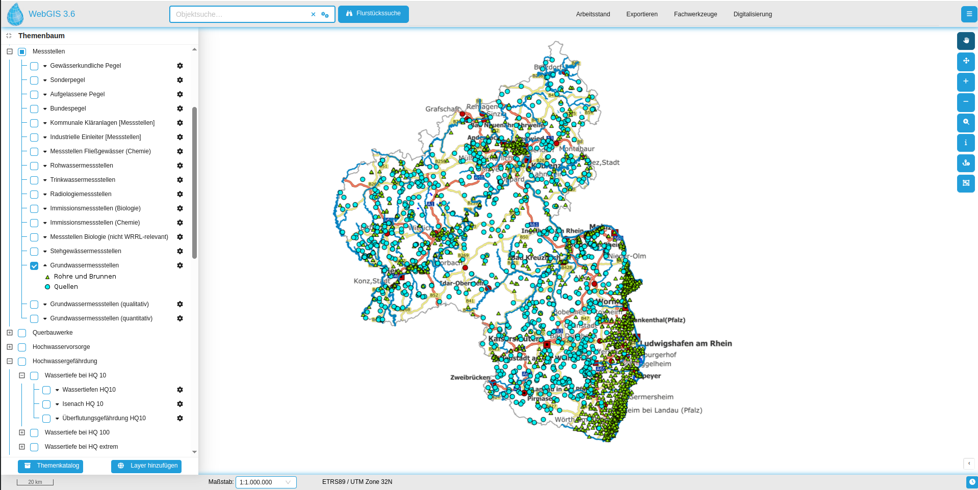
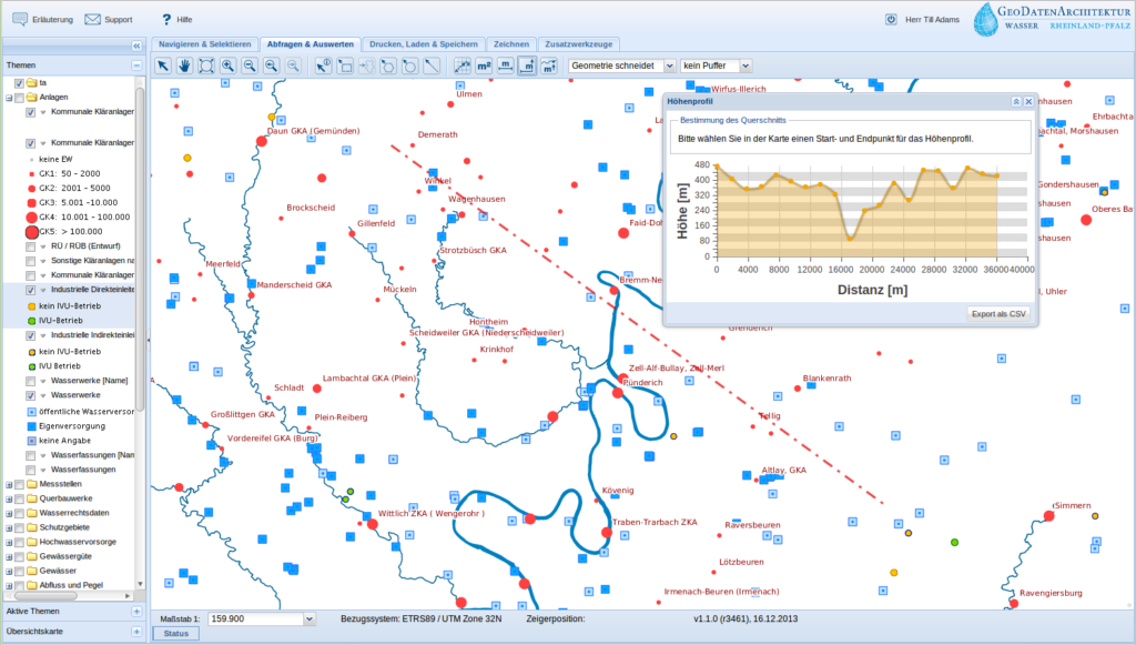
- Creation of powerful WebGIS clients:
- Implementation of common map functions (pan, zoom, queries, searches) as well as special functions such as an advanced print module, export and selection interfaces, digital editing tools and the ability to save work statuses.
- Development of a mobile client version for smartphones and tablets.
- Development of administration tools:
- Creation of an administration interface for the maintenance and management of geodata services, users, groups and the configuration of individual map viewers.
- Geodata management through simple data upload and drag & drop for the assignment of services and tools in WebGIS clients.
- Establishment of an INSPIRE-compliant metadata catalog: Implementation with GeoNetwork opensource for the publication of data and services in accordance with the INSPIRE Directive.
- Project management: Taking over project, quality and release management for smooth implementation.
- Operation and further development: Support of the entire system, including server operation, monitoring, installation of updates and continuous optimization of the application.
- Development of a new, responsive WebGIS client: Development of a modern client based on the React framework, which was originally designed for the public, but is now increasingly taking over the tasks of the previous administrative client.
Result
The application offers a flexible and powerful WebGIS that significantly facilitates the work of the water management administration and at the same time supports the public provision of relevant information.
In addition, continuous further development has been ensured:
- terrestris is responsible for operating the servers as well as monitoring and installing updates.
- A new, responsive WebGIS client based on the React framework is currently being developed. Originally designed for the public, it is increasingly taking over tasks of the previous administrative client and is setting new standards in user-friendliness and functionality.
Customer
State Office for the Environment (LfU), Rhineland-Palatinate