Besides our OGC-services we also offer acces to our regularly updated, worldwide OSM-Database in the form of vectortiles.
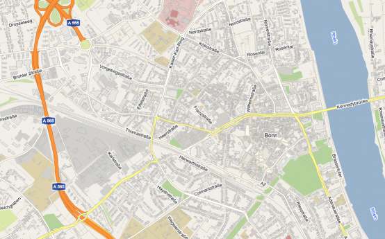
Vectortiles can look just like a regular WMS, e.g. our OSM-WMS:
Some opportunities of vectortiles over WMS are:
- High-performance compression and transmission of the data, amount of transferred data is often lower compared to WMS
- Clear and crisp type faces
- Fonts can be kept horizontal when rotating the map
- Interactivity with the data, no additional server communication needed
As the rendering of vectortiles happens on the client-side, performance is dependent on the power of the device. Computers like powerful Desktop PCs have an advantage over mobile phones here.
The Vectortiles are compliant to the Mapbox Vector Tile Specification and are served and cached by GeoServer.
We also developed a tiny library that helps you using this data. The library creates an ready-to-use OpenLayers Layer, which you can add to your own OpenLayers map.
The layer generated by the library is already styled similar to our OSM-WMS layer, so that you dont need to (but can, if you want to) care about the styling yourself.
Link to the library: https://github.com/terrestris/vectortiles
Base URL to the vectortiles: https://ows.terrestris.de/osm-vectortiles/
URL Schema: https://ows.terrestris.de/osm-vectortiles/osm:osm_world_vector@mapbox-vector-tiles@pbf/{z}/{x}/{-y}.pbf
As this service is based on the data of the OpenStreetMap-Project, you have to respect the corresponding copyright. If you use this service in your applications, make sure to include the copyright as stated here.
Demo (click for fullscreen):