In order to give you an impression of our work, we have compiled some of our completed projects here. Our customers are federal and state authorities, counties, municipalities and research institutions, but also companies and private organisations.
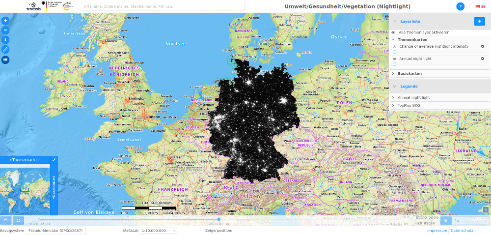
In the project Environment/Health/Vegetation funded by the Federal Ministry of Economics and Energy, methods for data combination and reconstruction of spatial parameters from satellite data were developed. The parameters processed include land surface temperature (LST), air quality (CAMS), weather data (DWD), night light and the plant disease fire blight.
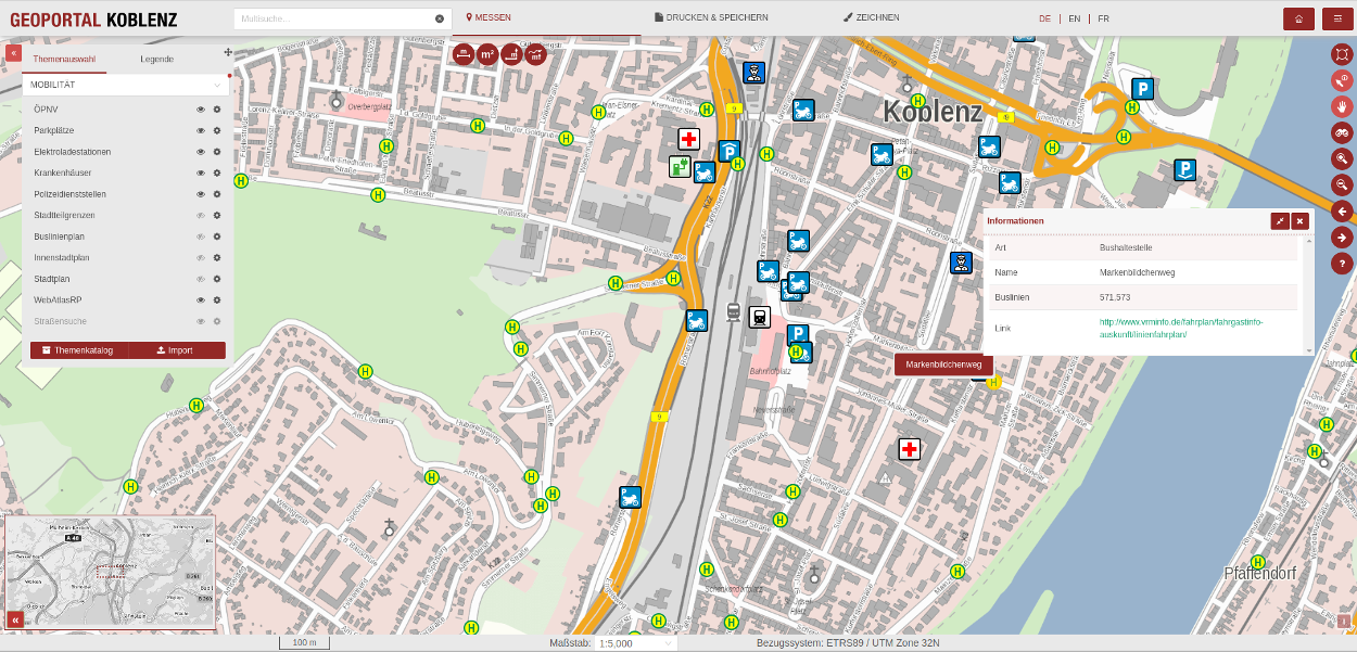
The INSPIRE-compliant GeoPortal Koblenz is available as a citizen portal for urban geodata. The user can initially access four different map services: “City Map”, “Building and Housing”, “Environment and Mobility” and “Soil Reference Values”. Various maps are available as a background: the official city map (in various versions), aerial photographs from the last 15 years, the WebAtlas Rhineland-Palatinate and the basic city map.
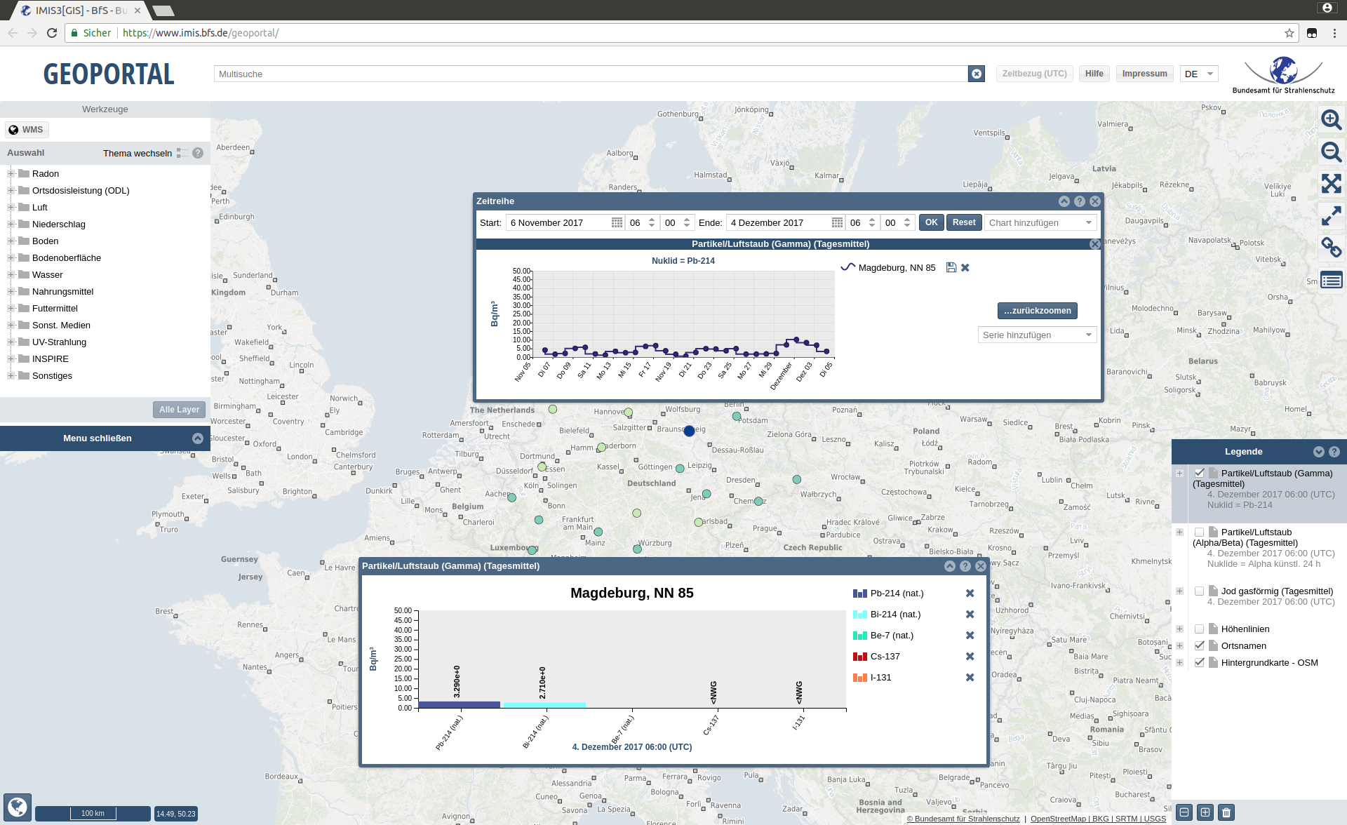
Federal Office for Radiation Protection (BfS)
At the federal level, the Federal Office for Radiation Protection (BfS) is responsible for emergency preparedness. It operates the integrated measurement and information system for monitoring environmental radioactivity (IMIS). For the BfS, a configurable application for optimal monitoring of the collected data was developed. IMIS continuously measures radioactive radiation in the environment at approx. 1,800 measuring points throughout Germany. In addition, there are numerous measurement data from other institutions, such as the German Weather Service, the Federal Institute for Hydrology and the State Offices for Environment and Nature. In addition, IMIS collects measurement data from over 60 laboratories and measuring stations abroad.
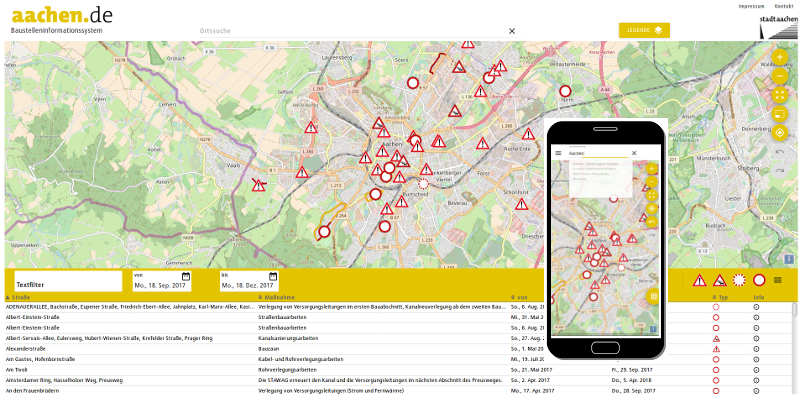
City of Aachen
With the construction site information system, the City of Aachen provides up-to-date information about traffic obstructions in the city area due to construction activities and special uses. It contains all measures of different originators, which were approved by the city of Aachen and probably lead to traffic obstructions (e.g. construction sites in road construction, construction sites in building construction with use of public traffic space, larger events).
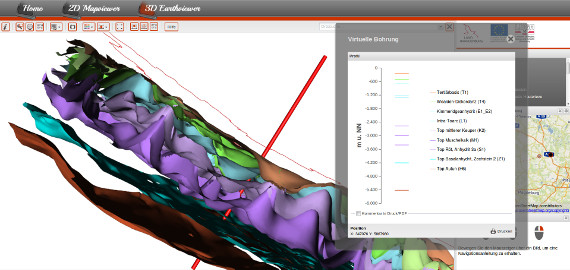
Brandenburg 3D
The State of Brandenburg, represented by the State Office for Mining, Geology and Natural Resources (LBGR), owns valuable data on the deeper subsoil based on reflection seismic surveys, which are to be made available to the public via the Internet. The aim is to enable access to 2D and 3D information without the need for special software, simply via the browser.
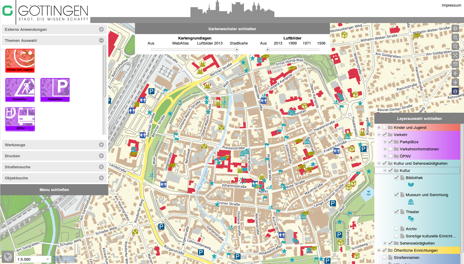
Stadt Göttingen
The city map of Göttingen has different themes and maps integrated. With the layer-slider, aerial photos of the last 80 years, for example, can be displayed “on-the-fly” at different times.
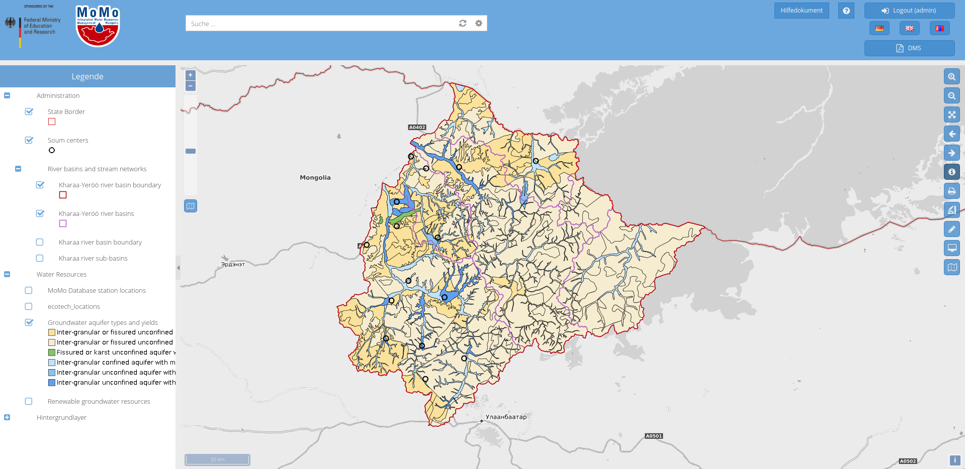
Integrated Water Resource Management in Central Asia: Model Region Mongolia (MoMo)
In this project, funded by the Federal Ministry of Education and Research (BMBF), terrestris has been responsible for geodata management since 2010. In addition to setting up a geoportal, the Mongolian partners were trained in how to use the technology. You can view a clone of the original WebGIS client here..
Geo Data Architecture (GDA) Water
The state of Rhineland-Palatinate has had the geoinformation systems in the water management administration newly developed and implemented ready for operation. The application offers a GIS client component as well as access to protected geoservices (WMS, WFS-T, WPS) and administration interfaces. The application is not publicly accessible.