Layername: TOPO-WMS and TOPO-OSM-WMS
Base URL: https://ows.terrestris.de/osm/service?
Capabilities-Document: https://ows.terrestris.de/osm/service?SERVICE=WMS&VERSION=1.1.1&REQUEST=GetCapabilities
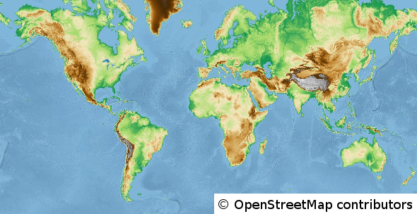
These two WMS show the world in a topographic manner.
The “TOPO-WMS” is based on the SRTM 450m and SRTM 30m digital elevation models (DEM) and represent the height with a classic colorrank. The resolution near the poles gets lower, as we use the global DEM with a resolution of 450m there.
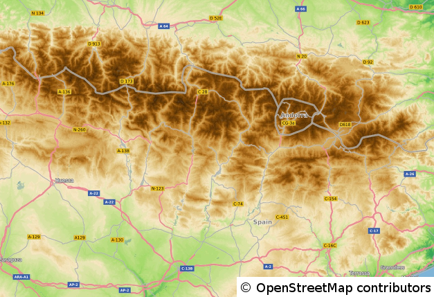
The service “TOPO-OSM-WMS” additionally shows data of the OpenStreetMap-Project, to get a better orientation with the help of borders, roads, places and waterareas.
The WMS is rendered with the help of GeoServer and is cached and accelerated with the help of MapProxy, updated weekly and covers the whole world.
We use the same mapscales like OpenStreetMap does, but we also added some useful cartographic scales to the range of cached zoomlevels:
- 1:1.000.000
- 1:500.000
- 1:250.000
- 1:100.000
- 1:50.000
- 1:25.000
These additional scales deliver good and readable results for maps that use these typical scales. The following coordinate system are available for the service:
- EPSG 4326 (WGS84)
- EPSG 25832 (ETRS89 / UTM Zone 32N)
- EPSG 31466 (DHDN / Gauss-Krüger Zone 2)
- EPSG 31467 (DHDN / Gauss-Krüger Zone 3)
- EPSG 31468 (DHDN / Gauss-Krüger Zone 4)
- EPSG 3857 / EPSG 900913 (Google Mercator Projection)
Notice:
As this service is based on the data of the OpenStreetMap-Project, you have to respect the corresponding copyright. If you use this service in your applications, make sure to include the copyright as stated here. Also review the capabilites document of this service to see the full list of data sources and copyright information.
Demo (click for fullscreen):