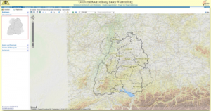
Geoportal Raumordnung BW
The
land use planning geoportal Baden-Wuerttemberg, which terrestris helped to implement, is now online.
Business Geomatics writes:
“
The undersecretary of state Gisela Splett from the Ministry of Traffic and Infrastructure formally launched the Land Use Planning Geoportal Baden-Wuerttemberg. Users are able to access textual and cartographic content in a comprehensive fashion regarding land use planning. Questions like: What does the land-use plan say regarding my residential district? Is my house located in a formally designated rehabilitation zone so that maybe I am eligible for a modernising grant? can be answered without having to actually visit the authorities. Municipalities that do not have their own geographical information system can provide the service to their citizens to take a look at the current land use plan. The portal is not only for adminstrations but also for industry and the interested public. With regard to content the portal is still in its initiation phase which means that current plans are not available for all parts of the state. The plans of some municipalities or older regional plans have only in part been brought up to date.”
Link to the portal

