We published a new style for our WMS Layer “OSM Overlay” which you can use free of charge as usual. The WMS is designed to be used together with other background data such as aerial imagery, satellite data and so on and mainly uses the data of the OpenStreetMap project.
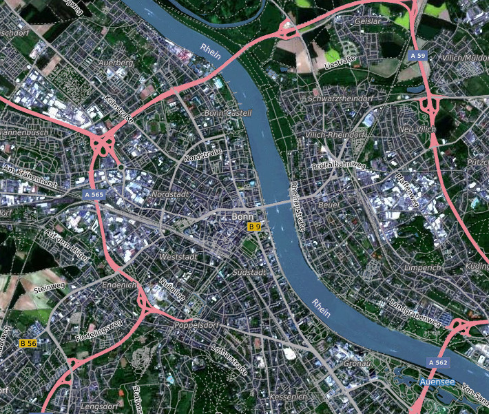
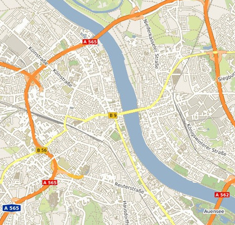
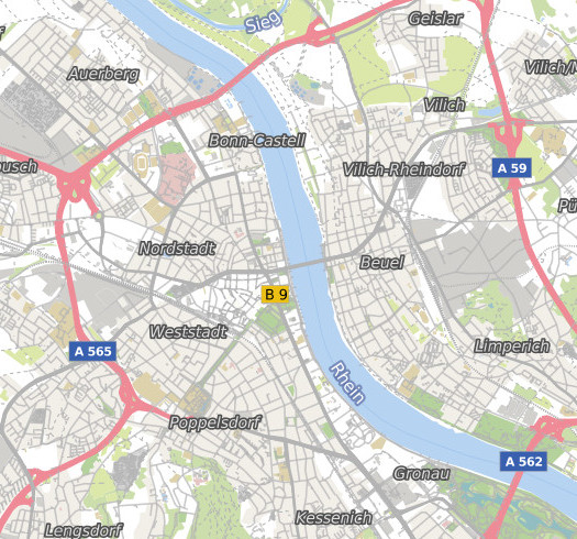
See the following pictures to get an idea what has changed compared to the old style of the WMS. The main aspect was to get a better and clearer readability, while also reducing some details e.g. of the road network.
On the left hand side the map is rendered with the old style, on the right hand side the new style is used. Both images use landuse information as background data:
The WMS is cached for better performance and usage is free of charge. For best results use the Google Mercator Projection EPSG:3857.
You can reach the WMS service with compatible software via
http://ows.terrestris.de/osm/service?
and by using the Layername
“OSM-Overlay-WMS”.
If you have any questions or wishes, do not hesitate to contact us!